↓
 

Roanoke Land Surveying

Land Surveying in Roanoke, Alabama

Roanoke Land Surveying
  • Home
  • About Us
  • ALTA Title Survey
  • Boundary Surveying
  • Civil Engineering
    • Flood Determination
  • Construction Survey
  • Drone LiDAR Mapping
  • Elevation Certificate
  • Land Surveying
  • Services
  • Topographic Survey | Topo Survey
  • Blog
  • Contact
Home 1 2 3 … 5 6 >>

Post navigation

← Older posts

Roanoke Land Surveying

Roanoke Land Surveying Posted on September 10, 2010 by SurveyorOctober 20, 2012

Welcome to Roanoke Land Surveying

roanoke land surveying

Welcome to our site. We want to provide you with information on Land Surveying in general and specifically in the Roanoke, Randolph County area of Alabama.If you have any land surveying questions, you’ve come to the right place.

Land Surveying is a very important industry, and it has been around for ages. To know more about the basics of land surveying, you can click here.

Land Surveyors are professionals who measure and make precise measurements to determine the size and boundaries of a piece of real estate.  While this is a simplistic definition, this is one of the most common types of surveying related to home and land owners. To know more about what a land surveyor does, click here.

What to expect from Roanoke Land Surveying

If you need assistance on any land surveying services, we are the best people to help you out. We give nothing but the best service, and we have the best deals in town.

Roanoke Land Surveying offers different land surveying services. We also offer Boundary surveying, Percolation surveying, Septic System Design, Subdivision Design, Topo Surveying and House Site Plans.

How to contact Roanoke Land Surveying?

CALL Roanoke Land Surveying TODAY at 256-854-9503 to discuss your land survey needs.

Posted in land surveying, land surveyor | Tagged boundary surveying, land surveying, land surveyors, lot survey, Roanoke Land Surveying

How to Find Property Lines Without a Surveyor

Roanoke Land Surveying Posted on June 5, 2026 by SurveyorJune 1, 2026

Homeowner checking approximate property lines on a smartphone app in a backyard

Not every situation calls for hiring a licensed surveyor right away. Sometimes you just need a general idea of where your property starts and ends before you plant a row of trees, plan a garden bed, or have a conversation with your neighbor. The good news is that several free and low-cost methods can give you a solid starting point. None of them replace a professional survey for legal purposes, but they are useful, practical, and easy to access.

Here is a clear look at five ways to find your property lines on your own.

1. Check Your Property Deed

Your property deed is the most important document you own as a landowner. It contains a legal description, which is a written set of directions and measurements that describe the exact boundaries of your land.

Legal descriptions come in a few common formats:

  • Metes and bounds describe boundaries using compass directions and distances. It starts from a fixed point and traces the perimeter. This format is common in older eastern states and rural areas.
  • Lot and block references a recorded plat map using a lot number and block number. This is typical in subdivisions.
  • Government rectangular survey divides land into townships, ranges, and sections. This format is most common in the western United States.

Reading a legal description can feel confusing at first, but even understanding the basics helps you know where to look on a map or in the field.

To get a copy of your deed, check your closing documents from when you purchased the property. You can also visit your county recorder’s office or clerk’s office in person. Many counties now post deed records online through their official websites at no cost.

2. Look Up Your Plat Map

A plat map is an official diagram of a subdivision or parcel of land that has been recorded with the county. It shows individual lot boundaries, lot dimensions, street widths, easements, and how neighboring lots relate to one another.

Plat maps are especially helpful if your property is part of a subdivision. They are filed with the county recorder’s office and are public record, meaning anyone can view them for free.

To find yours, visit or search the website for your county recorder’s office, assessor’s office, or register of deeds. Many counties have also digitized their plat records, so a simple search for your county name along with the words “plat map” or “plat records” will often get you there quickly.

One thing to keep in mind: a plat map shows the planned or recorded boundaries at the time the plat was filed. Changes that happened after that date, such as old encroachments or structures that shifted over time, may not appear on the map.

3. Use a County GIS Parcel Map

Most counties in the United States offer a free online GIS (Geographic Information System) parcel viewer. These tools display property boundaries overlaid on aerial or satellite imagery, so you can see where your lot lines fall in relation to your home, driveway, and yard.

To find yours, search Google for your county name followed by “GIS parcel map” or “parcel viewer.” Once you are on the tool, enter your address or parcel number. Your property boundary will appear as a colored outline on the map.

GIS maps are a quick and convenient way to get a visual picture of your property. However, they carry a margin of error that can range from 5 to 30 feet depending on the county and the age of its records. They work well for general reference but are not precise enough for construction, permit applications, or legal disputes.

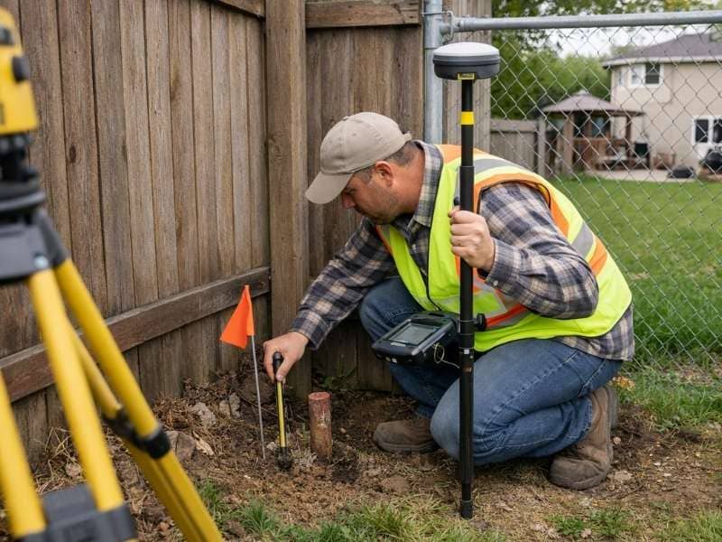
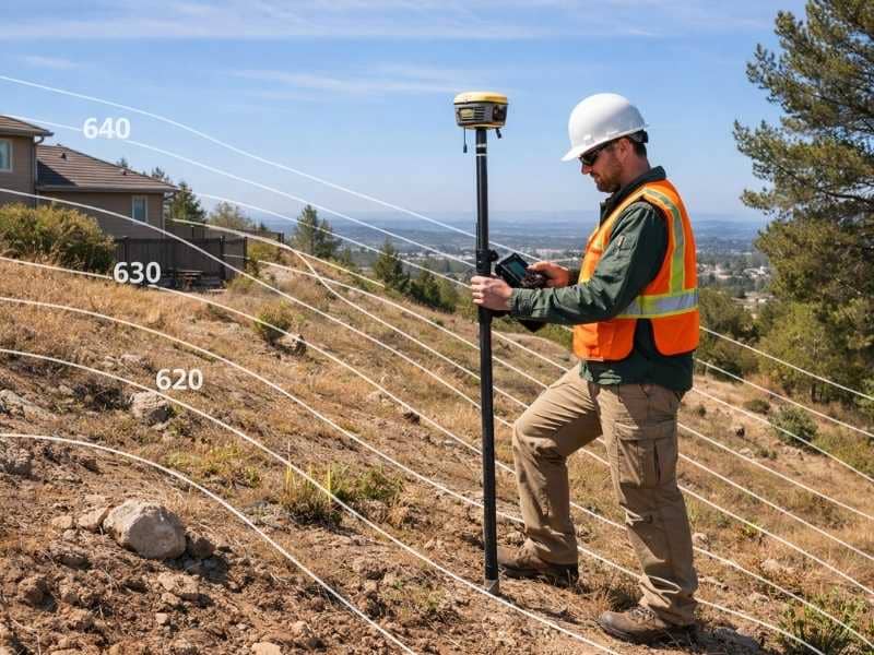
4. Look for Survey Pins

Survey pins are physical markers set in the ground by licensed surveyors to mark the corners of a property. They are one of the most direct ways to find a boundary line because they represent where a surveyor has already been.

Survey pins are typically made of iron rebar or iron pipe, ranging from 18 to 24 inches in length. A metal cap or tag stamped with the surveyor’s license number is often attached to the top. In some cases, orange or pink flagging tape may mark a recently set pin. Older properties may have stone monuments, concrete posts, or brass discs set into nearby sidewalks or roads.

Because pins are often buried just below the surface, they are not always visible to the naked eye. A basic metal detector set to detect ferrous metal can help you locate them. Walk along the perimeter of your property, especially near corners. Cross-referencing your search area with your plat map or deed gives you a better idea of where to look.

One important rule: never move, pull out, or reset a survey pin. In most states, disturbing a survey monument is a criminal offense and can create serious legal problems.

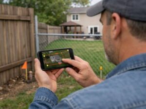
5. Use a Property Boundary App

Smartphone apps have made it easier than ever to view approximate property lines from wherever you are standing. Several free and low-cost apps pull parcel data from county tax assessor records and display it as an overlay on a satellite map using your phone’s GPS.

To use one, search your device’s app store for “property boundary” or “parcel map” apps. Enable location services, enter your property address, and your parcel boundary will appear on the map within seconds. You can walk your lot while watching your position move on the screen, which gives you a real-time sense of where the lines fall.

These apps are convenient and surprisingly informative for everyday use. Keep in mind that the parcel data they pull is designed for tax assessment purposes, not legal boundary determination. Accuracy varies by county, and the lines displayed can be off by several feet in either direction.

When You Need More Than a DIY Method

The five methods above are genuinely useful for getting your bearings, but there are situations where they simply are not enough. A licensed land surveyor is the right choice when:

  • You are building a fence, garage, addition, or any permanent structure near a property line
  • A permit application requires a current survey
  • You are involved in a boundary dispute with a neighbor
  • You are buying or selling land and a lender or title company requires a formal survey
  • You want to subdivide your property into separate lots

According to research cited by UpCounsel, 4 in 10 property conflicts in the United States stem from boundary misunderstandings. A professional boundary survey, which typically costs between $500 and $1,200 for a standard residential lot, can prevent disputes that cost far more to resolve later.

The DIY methods in this article are a good first step. They help you understand your property, prepare better questions, and make more informed decisions. For anything that carries legal or financial weight, a licensed land surveyor provides the only answer that holds up in court.

Frequently Asked Questions

Can I find my property lines for free? 

Yes, to a point. Deeds, plat maps, county GIS parcel viewers, and boundary apps are all free or low-cost and give you useful reference information. None of them produce a legally binding result, but they are a solid starting point for most everyday needs.

Is Google Maps accurate enough for property lines? 

No. Google Maps does not display legal property boundaries. County GIS parcel viewers use actual parcel data and are more accurate for reference purposes, though they still carry a margin of error.

What happens if I accidentally build on my neighbor’s property? 

Even an unintentional encroachment can lead to a legal dispute, demands to remove a structure, or costly negotiations. Checking your boundaries before breaking ground is always the smarter approach.

Are property line apps legally reliable? 

No. Property boundary apps pull data from tax assessor records, which are not designed for precise boundary determination. They are useful for general awareness but should not be used to make construction or legal decisions.

Posted in land surveying | Tagged land surveying

Do I Need a Land Survey to Build a Fence?

Roanoke Land Surveying Posted on June 3, 2026 by SurveyorJune 1, 2026

Surveyor performing a land survey to locate a property boundary before fence installation

Building a fence sounds simple enough. You pick a style, hire someone to install it, and that is that. But before the first post goes into the ground, there is one question worth asking: do you actually know where your property line is?

A fence in the wrong place is not just an awkward situation. It can become a legal problem that costs far more to fix than a survey ever would.

Virginia law does not require a land survey before building a fence. You can legally buy materials, hire a contractor, and install a fence without ever ordering one.

But whether that is a good idea depends entirely on how confident you are about where your property line actually sits. If there is any doubt at all, getting a survey first is almost always the smarter and cheaper choice.

What Virginia Law Says About Fences

Virginia Code sections 55.1-2820 through 55.1-2825 govern what are called partition fences. These are fences built on or along a shared property line between two neighboring properties.

Under Virginia Code Section 55.1-2821, adjoining landowners are generally required to build and maintain division fences between their lands, splitting the costs equally, unless one party agrees to something different in writing.

That matters for one important reason. If your fence ends up on the wrong line, even by accident, it can create shared legal obligations your neighbor never agreed to. It can also give them the right to demand you move it.

Some localities also require a permit before fence installation, and some of those permit applications ask you to show the fence location relative to your property lines. Without a survey or an accurate plat, you may not be able to prove your fence meets the local setback rules.

What Can Go Wrong Without a Survey

Encroachment

A fence that crosses onto a neighbor’s property, even by a few inches, is considered an encroachment. In Virginia, a property owner has the legal right to demand removal of any structure that encroaches on their land. That means tearing out what you built and doing it again, at your own expense.

Adverse Possession

This one surprises most homeowners. Under Virginia Code Section 8.01-236, a neighbor who openly and continuously uses a strip of your property for 15 years or more may be able to claim legal title to it. A fence placed in the wrong spot and left unchallenged for long enough can quietly cost you a portion of land you legally own.

Permit Problems

If your project requires a permit and the permit office asks for proof that your fence meets setback requirements, an old plat or a hand-drawn sketch usually will not satisfy them. A current survey from a licensed surveyor gives you the documentation you need.

When a Survey Is Strongly Recommended

Not every fence project needs a survey. But there are situations where skipping one is a real risk.

You should seriously consider ordering a survey before building a fence when:

  • You have never had a survey done on the property
  • Your existing survey is more than five to ten years old
  • You do not know where your property corners are marked
  • Your lot line runs close to a neighbor’s structure, driveway, or existing fence
  • You and your neighbor disagree, even slightly, about where the line sits
  • Your project is near an easement or utility corridor

According to a national survey by a fence industry research group, 16 percent of American homeowners have had a property line dispute with a neighbor. Encroachment from fences is one of the most common causes of those disputes.

What Type of Survey Do You Need?

For fence installation, a boundary survey is the right choice. A boundary survey locates and physically marks your exact property corners and lines on the ground. That gives you a legally accurate starting point for placing your fence.

A topographic survey, which maps the slopes and drainage features of the land, is generally not needed for a fence project unless your lot has significant grade changes along the fence line that could affect drainage or structural design.

How Much Does a Fence Survey Cost?

A boundary survey for fence placement in Virginia typically costs between $400 and $800 for a standard residential lot. The final price depends on lot size, terrain, and how much existing documentation the surveyor has to work with.

To put that in perspective: tearing out a fence that was placed over the property line, rebuilding it in the correct location, and dealing with any legal back-and-forth with a neighbor can cost several times that amount. The survey pays for itself quickly when you consider what it prevents.

Frequently Asked Questions

Can I use my property deed instead of a survey? 

A deed describes your property in legal terms, but it does not physically mark where your lines are on the ground. A licensed surveyor takes that legal description and translates it into actual markers you can see and use. The deed tells you what you own. The survey shows you where it is.

What if my neighbor and I agree on where the line is? 

A verbal agreement between neighbors is not a legal boundary. If either property is ever sold, refinanced, or the subject of a dispute, what two people agreed to over a handshake carries no legal weight. A licensed survey is the only document that establishes the boundary with legal standing.

Do old surveys still count? 

An older survey may still be valid if nothing on the property has changed and the corner markers are still in place. However, if markers have been moved, the land has been altered, or the survey is more than a decade old, a new one gives you the most reliable information.

Who pays for the survey when building a shared fence? 

If both neighbors want the fence and want to share costs, splitting the survey cost is a reasonable arrangement. Virginia law requires equal cost-sharing for partition fences unless both parties agree otherwise, so starting the project with a clear and shared understanding of where the line sits benefits everyone involved.

Posted in land surveying | Tagged land survey, land surveying

What a Topographic Survey Tells You About Your Property

Roanoke Land Surveying Posted on June 1, 2026 by SurveyorJune 1, 2026

Land surveyor using GPS equipment to perform a topographic survey on a sloped residential property with contour lines showing elevation changes

Roanoke is a great place to own land. The Blue Ridge Mountains surround the valley, the ground rolls up and down, and no two properties look the same. But that same landscape that makes the area beautiful also makes building on it tricky.

Before anyone starts building, pouring a foundation, or moving dirt, there is one document that builders and engineers always ask for first: the topographic survey.

What Is a Topographic Survey?

A topographic survey is a detailed map of a property. It shows the hills, slopes, drainage paths, trees, and how the ground rises and falls across the land.

A boundary survey only shows where your property ends and your neighbor’s begins. A topographic survey goes further. It shows what the land looks like on the inside, where water flows, where the ground gets steep, where trees and buildings sit, and how the whole property sits in relation to everything around it.

The finished product is a contour map. This is a drawing that uses lines to show changes in height across the property. Lines close together mean a steep slope. Lines far apart mean the ground is mostly flat.

How Is It Different From a Boundary Survey?

This is one of the most common questions people ask, and it deserves a simple answer.

A boundary survey answers the question: “Where is my property?”

A topographic survey answers a different question: “What does my property actually look like?”

One shows your legal lines. The other shows your land’s shape, slopes, and drainage. Many building projects need both, not just one.

What Does a Topographic Survey Show?

A licensed surveyor takes measurements across the whole property to build an accurate picture of the land. The finished survey usually shows:

Natural features: Streams, ponds, hills, rock formations, and large trees.

Man-made features: Buildings, fences, driveways, walls, utility lines, and drainage systems already on the property.

Elevation and contour lines: The exact height of the ground at measured points across the lot, shown as lines on the final map.

Together, this information gives builders and planners a full picture before any work begins.

Why Roanoke Properties Need Topographic Surveys

Not every property in Virginia needs a topographic survey. But Roanoke is a different situation.

The city sits at about 1,093 feet above sea level. The Blue Ridge ridges around it climb above 2,600 feet. That is a big difference in height across a small area. It means slopes, drainage problems, and uneven ground are common here.

Downtown Roanoke was actually built on top of a buried creek. That is one reason flooding has been a concern in the city for a long time. The Peters Creek watershed covers 5,784 acres that drain through the northwest part of the city. Over the years, the City of Roanoke has spent more than $13 million to reduce flood damage across 139 homes and structures. That is what can happen when drainage is not understood before building begins.

For property owners, a topographic survey is not an optional extra. It is a practical tool on any lot with slopes, nearby water, or a project that involves moving or grading the ground.

When Do You Need One?

Before building a home or an addition. Builders need this data to design a structure that fits the land properly. Without it, drainage problems often show up after construction, when they are costly to fix.

For drainage and grading projects. If your yard has standing water or erosion, a topographic survey shows exactly where water is going and where the problem starts.

When applying for permits in Roanoke. The City of Roanoke requires new buildings in floodplain areas to be elevated at least two feet above base flood level. Knowing whether your property falls into that category starts with accurate elevation data from a topographic survey.

Before major landscaping or retaining wall projects. Retaining walls and terracing need to be designed around the actual grade of the land. A topographic survey gives your contractor the information to do that correctly.

How Much Does It Cost?

Topographic surveys for homes in the United States generally cost between $1,500 and $6,500. The price depends on the size of the lot, how steep or wooded it is, and how much detail the project needs.

In Roanoke, where wooded slopes and uneven ground are common, surveys often fall toward the higher end of that range.

One useful fact: if a topographic survey was done within the last one to five years and the land has not changed much, a licensed surveyor may be able to update it instead of starting over. That can save property owners between 30 and 50 percent compared to a brand-new survey.

Frequently Asked Questions

Can I use Google Earth instead of a topographic survey? 

No. Google Earth shows general satellite images but does not have the accuracy or legal standing needed for permits or construction. Only a survey done by a licensed land surveyor is accepted for official purposes.

How accurate is a topographic survey? 

Very accurate. Licensed surveyors use specialized equipment including GPS receivers, total stations, and sometimes LiDAR technology to measure the ground precisely. The data is accurate enough for engineering, permits, and legal records.

Is a topographic survey required for permits? 

It depends on the project. Grading permits and any building in a floodplain area often require elevation data that only a topographic survey provides. Checking with the City of Roanoke’s Department of Planning, Building and Development before starting a project is always a smart first step.

Do I need a topographic survey to build a fence? 

Usually not. A boundary survey is enough for most fence projects. If your lot has major slopes or drainage issues near the fence line, a topographic survey can be helpful but is rarely required.

Posted in land surveying | Tagged topographic survey

Post navigation

← Older posts

    © Roanoke Land Surveying
    Roanoke, AL.
    Phone: (256) 854-9503

    Web Development and SEO by:
    N2Biz.co


    Privacy Policy | Terms of Use

    The owner of this website, USA Surveying & Engineering, LLC., provides coordination of professional land surveying and engineering services in all 50 states. The professional surveying and engineering services provided to you will be conducted by fully licensed professionals in your state.

    Privacy Policy
    ↑